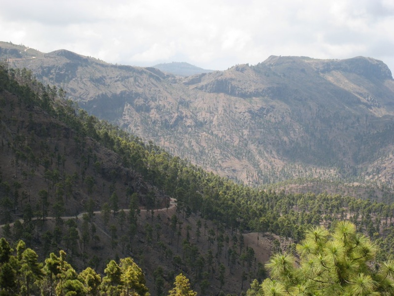
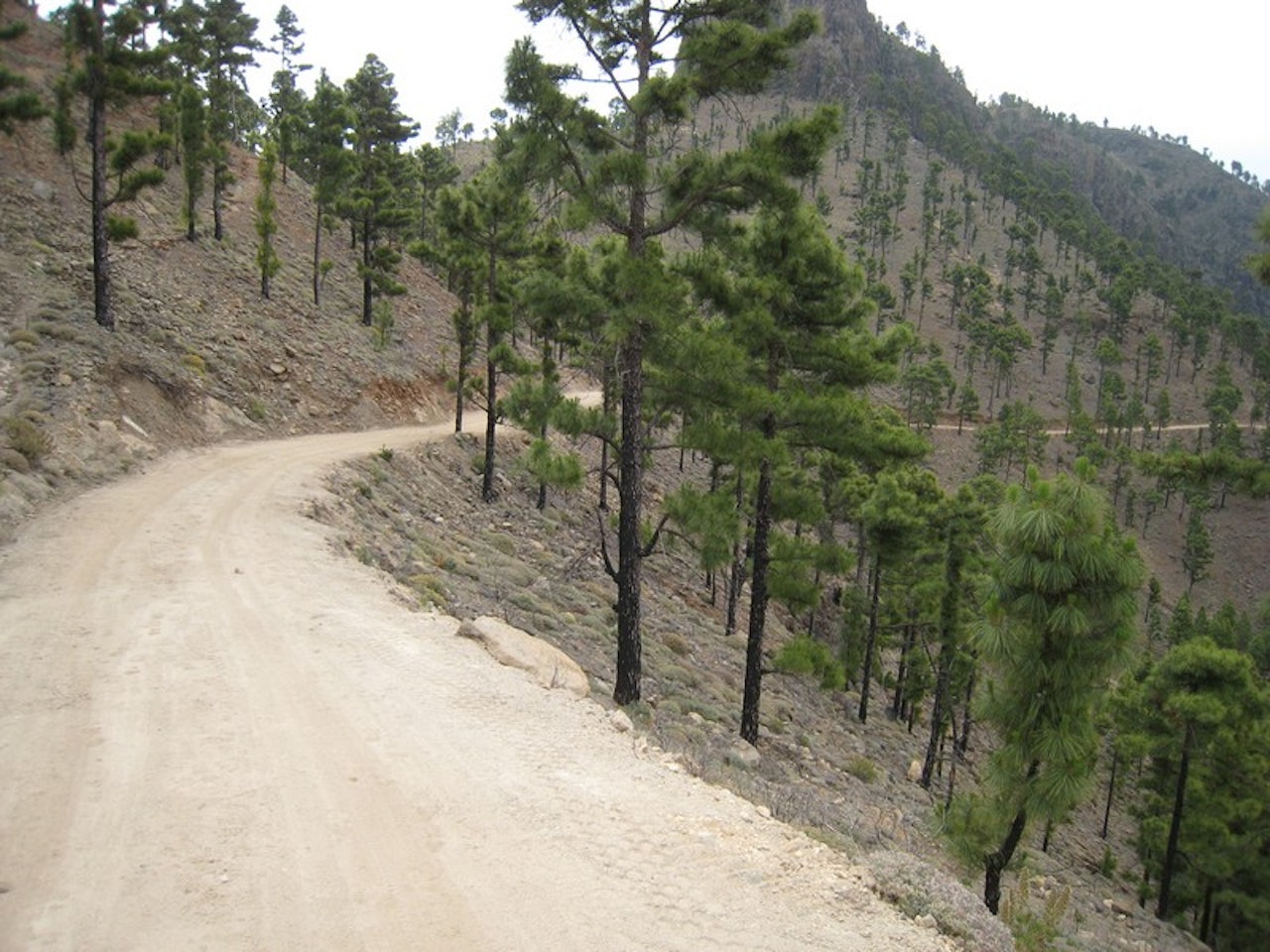
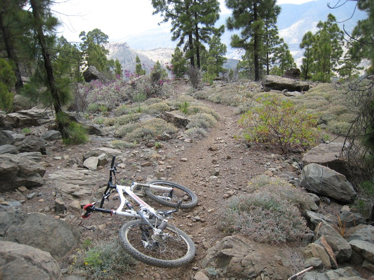
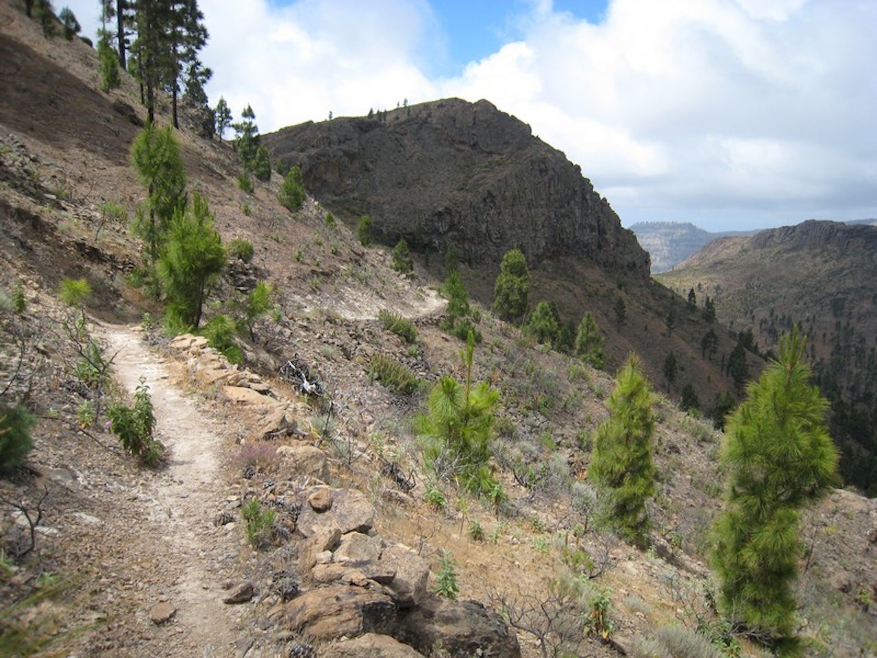
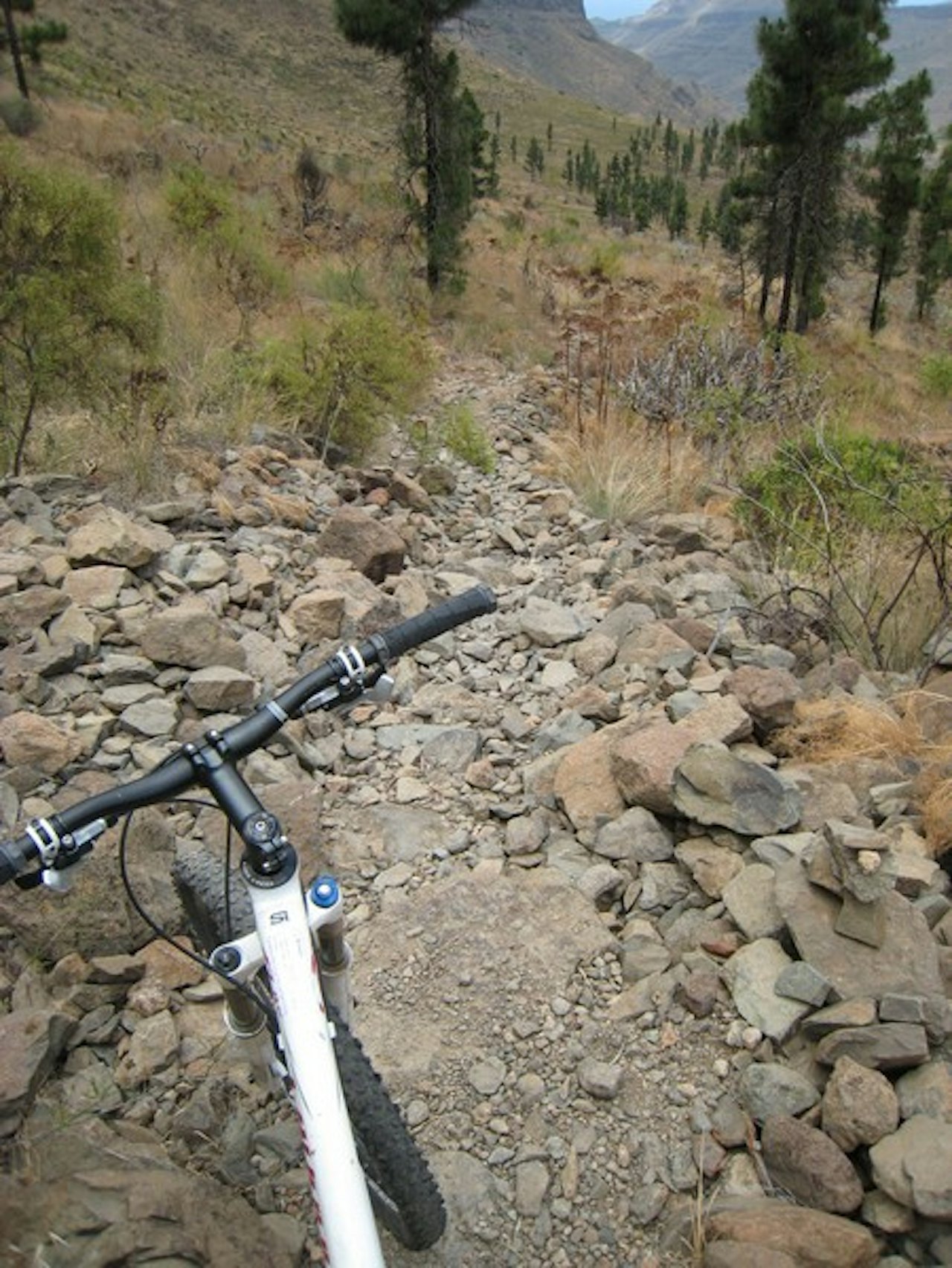
Fantastic route that starts at Cruz Grande with flowing and twisty gravel, then slightly scary and rocky singletrack on ledges and flowing hillsides to the dam in Ayagaures. The last 10km on asphalt to Maspalomas. The view was fantastic and the singletrack rocky and technical. This route originally starts at Pico de las Nieves, another 700 vertical meters further up.This route is not on any of the trips offered by the tour operators as it is considered to be too challenging with regard to technical difficulty on the singletrails. It is challenging in sections, but just take it easy and you'll manage.Get to the Cruz Grande pass and take the trail/gravel road that starts on the right side off the cliff (not facing San Bartolomé), then follow for a few kilomtres to the panoramic viewpoint where you look out over the San Bartolomé-valley. Follow the Maspalomas sign and after 200m there is a trail starting to the right and slinging it's way down. In the second turn, go straight ahead and follow the singletrail along the hillside (still heading towards the ocean). Get ready for some amazing views and epic riding!When you get close to the dirt road in the valley you will see some black plastic water pipelines. Cross over to the road and follow for another 300m past the pumphouse and two very small dams. Then the trail drops to the right again (straight ahead is a dead end). You'll ride along the hillside to Ayagaures and cross the dam there. Take a break at the bar by the church. You've completed around 20km of singletrail!Due to the rocks on the trail and plants and bush by the trail I recommend to use arm and knee-proctectors (full length is optimal).PS! From the start of the single trail there I had no cell-phone coverage untill Ayagaures. Keep it in mind, especially if you ride solo.See the excellent hiking trail maps from www.kompass.at which can be bought at the www.free-motion bike shops. Be aware that not all trails on this trip are on that map either.
Du leser nå en eldre, brukergenerert stiguide, skrevet av en av våre lesere. Terrengsykkel.no har ikke verifisert at denne informasjonen stemmer. Husk å alltid sette deg inn i lokale stiforhold og eventuelle ferdselsrestriksjoner.
HVOR?
- Kommune: Gran Canaria
- Lengde: 20-30 km
- Tidsbruk: 2-3 timer
- Vanskelighetsgrad: 4. krevende
Slik kommer du dit
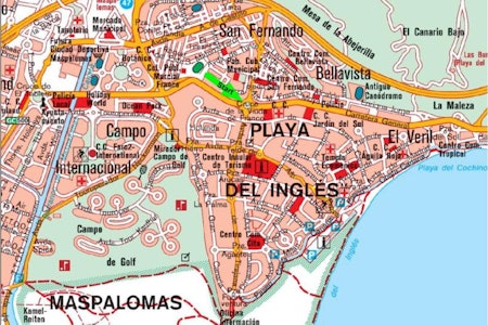
Følg veien GC60/GC815 fra Maspalomas til San Bartolomé og videre til passet Cruz Grande.
Endepunkt
Maspalomas (evt Playa del Ingles)
Terreng
Starter med fin grusvei, så steinete sti langs åsene ned mot dammen i Ayagaures.
Rutebeskrivelse
GPS
Tips
Kjøp kartet fra www.kompass.at i Free-motions sykkelbutikk.
Publisert 6. juni 2011 kl 00.00
Sist oppdatert 6. juni 2011 kl 00.00